
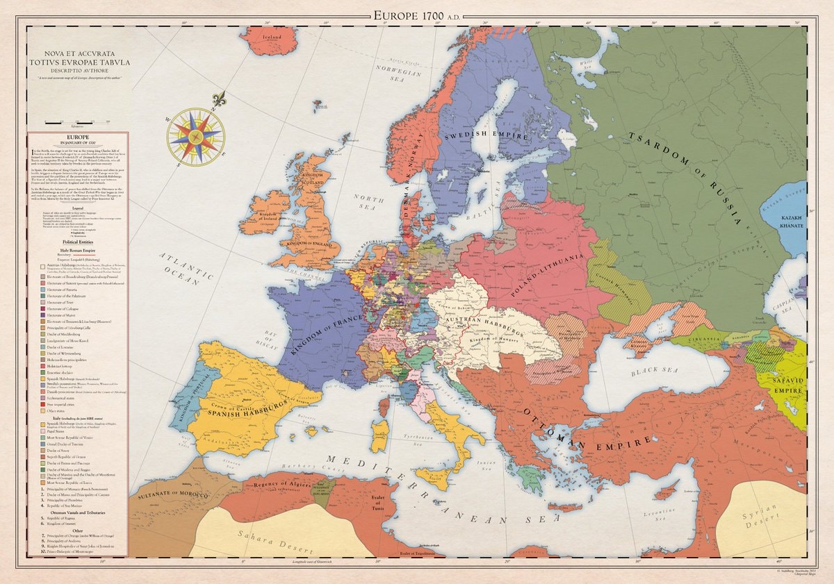
@scarlett_sA whole different map back then, Europe was something else in 1700
元の投稿を見る@scarlett_sA whole different map back then, Europe was something else in 1700
元の投稿を見る@scarlett_sさんの写真· Aug 30, 2026· News
The image is a historical map of Europe in 1700 AD. It displays political boundaries and territories with various colors representing different empires and kingdoms. The map has a vintage aesthetic with a compass rose and a detailed legend. A notable detail is the extensive coloring of the Holy Roman Empire into many smaller states. ON-SCREEN TEXT: EUROPE 1700 A.D. NOVA ET ACCVRATA TOTIVS EVROPAE TABVLA DESCRIPTIO AVTHORE "A new and accurate map of all Europe. Description of the author." Legend Political Entities Holy Roman Empire Boundary Additional (Habsburgs, Electors, etc.) Electorate of Bavaria Electorate of Cologne Electorate of Mainz Electorate of Trier Electorate of Saxony Electorate of Brandenburg Electorate of the Palatinate Duchy of Bavaria Duchy of Saxe-Lauenburg (Saxony) Duchy of Saxe-Gotha Duchy of Saxe-Meiningen Duchy of Saxe-Weimar Principality of Ansbach Princip
 2Beoga withdraws from Ed Sheeran Loop tour
 2Trump administration Israel arms sale
 3Houthis 54 airstrikes Saudi Arabia
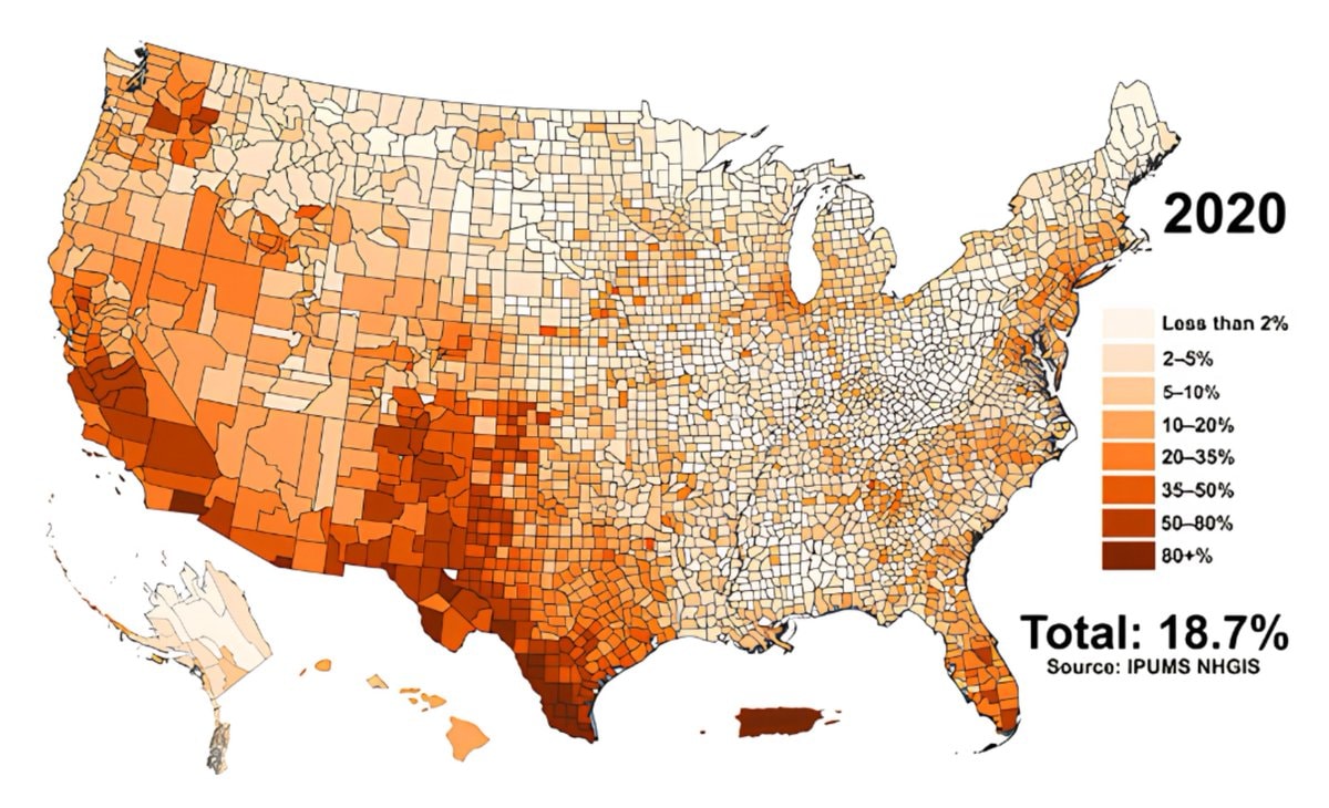 Hispanic population share by U.S. county
 Basil on 9/11 and Hasan brigade
 Philip DeFranco calls out Ed Sheeran Macklemore
 AEW For The Sickos trademark
 2Charlie Kirk isekai web novel deleted
 2Uber layoffs and autonomous taxi investment
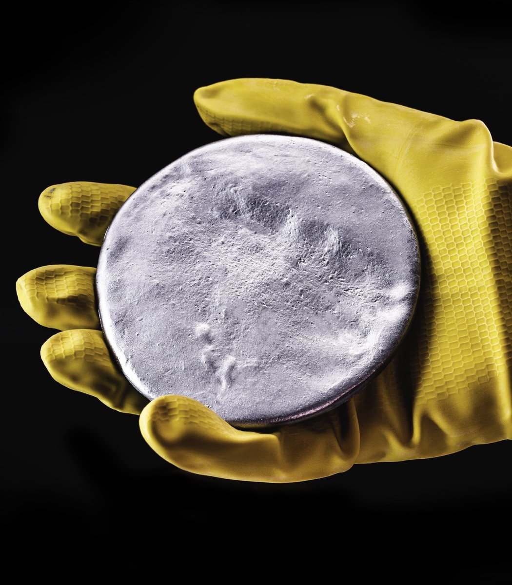 2Saudi Arabia uranium discovery
 2China AI security risk prevention system
 2Egypt solar panels agriculture
 2Bernie Sanders superintelligent AI bill
 2Benedict Cumberbatch on climate and populism
 2EU directive on green claims
 2Thomas Matthew Crooks cremation details
 2Thomas Matthew Crooks cremation donor
 I'm single and searching 😔
@scarlett_sA whole different map back then, Europe was something else in 1700
元の投稿を見る@scarlett_sさんの写真· Aug 30, 2026· News
The image is a historical map of Europe in 1700 AD. It displays political boundaries and territories with various colors representing different empires and kingdoms. The map has a vintage aesthetic with a compass rose and a detailed legend. A notable detail is the extensive coloring of the Holy Roman Empire into many smaller states. ON-SCREEN TEXT: EUROPE 1700 A.D. NOVA ET ACCVRATA TOTIVS EVROPAE TABVLA DESCRIPTIO AVTHORE "A new and accurate map of all Europe. Description of the author." Legend Political Entities Holy Roman Empire Boundary Additional (Habsburgs, Electors, etc.) Electorate of Bavaria Electorate of Cologne Electorate of Mainz Electorate of Trier Electorate of Saxony Electorate of Brandenburg Electorate of the Palatinate Duchy of Bavaria Duchy of Saxe-Lauenburg (Saxony) Duchy of Saxe-Gotha Duchy of Saxe-Meiningen Duchy of Saxe-Weimar Principality of Ansbach Princip
2Beoga withdraws from Ed Sheeran Loop tour2Trump administration Israel arms sale3Houthis 54 airstrikes Saudi ArabiaHispanic population share by U.S. countyBasil on 9/11 and Hasan brigadePhilip DeFranco calls out Ed Sheeran MacklemoreAEW For The Sickos trademark2Charlie Kirk isekai web novel deleted2Uber layoffs and autonomous taxi investment2Saudi Arabia uranium discovery2China AI security risk prevention system2Egypt solar panels agriculture2Bernie Sanders superintelligent AI bill2Benedict Cumberbatch on climate and populism2EU directive on green claims2Thomas Matthew Crooks cremation details2Thomas Matthew Crooks cremation donorI'm single and searching 😔